ViewTube

ViewTube
Sign inSign upSubscriptions
Filters

Upload date

Type

Duration

Sort by

Features

Reset

4,071 results

The NDS Show and Open Geospatial Solutions
The AI Revolution in Geospatial Intelligence (Why Everything Is About to Change) | Dr. Qiusheng Wu

Geospatial AI is transforming how we understand the world—faster, more accurately, and at a scale never seen before. In this ...

1:08:06
The AI Revolution in Geospatial Intelligence (Why Everything Is About to Change) | Dr. Qiusheng Wu

247 views

1 day ago

The NDS Show and Open Geospatial Solutions
Is it worth learning GEOSPATIAL? (Will A.I. Eat Earth Observation?)

Is AI really ready to replace human analysts in geospatial intelligence? In this deep-dive conversation with geospatial expert ...

4:30
Is it worth learning GEOSPATIAL? (Will A.I. Eat Earth Observation?)

215 views

4 days ago

National States Geographic Information Council
GIS 101: Metadata Then and Now | April 9, 2026

Metadata has always helped us understand and trust our GIS data—but how much has it really changed over the years?

1:02:18
GIS 101: Metadata Then and Now | April 9, 2026

118 views

3 days ago

AI InterConnect
How Geospatial Data is Reshaping Cities and Mobility with Antonio Cantalapiedra

In this episode, Antonio Cantalapiedra, CEO of geoReplica, shares insights on digital twins, geospatial data, and the future of ...

39:01
How Geospatial Data is Reshaping Cities and Mobility with Antonio Cantalapiedra

118 views

17 hours ago

AI Research Roundup
UNIGEOCLIP: Aligning 5 Geospatial Modalities

In this AI Research Roundup episode, Alex discusses the paper: UNIGEOCLIP: Unified Geospatial Contrastive Learning ...

4:18
UNIGEOCLIP: Aligning 5 Geospatial Modalities

12 views

1 day ago

Special Competitive Studies Project
Commanding the High Ground: AI’s Role in Maintaining U.S. Geospatial Dominance

At the AI+ Intelligence event hosted by SCSP, VADM Frank Whitworth (Former Director, NGA) detailed how the National ...

31:08
Commanding the High Ground: AI’s Role in Maintaining U.S. Geospatial Dominance

108 views

4 days ago

Spatial Lens
Will Remote Sensing Replace Field Work? The Real Answer

Can remote sensing really replace field work? In this video, we break down the real difference between remote sensing, GIS, and ...

5:43
Will Remote Sensing Replace Field Work? The Real Answer

37 views

5 days ago

GIS Developer
This is What Separates GIS Analysts from GIS Developers | PostgreSQL

LULC Course: https://www.udemy.com/course/google-earth-engine-supervised-classification-for-lulc/?

5:08
This is What Separates GIS Analysts from GIS Developers | PostgreSQL

74 views

5 days ago

Geospatial World
Tech Mahindra Is Embedding Geospatial into an Autonomous, AI-Driven World

In an exchange with Dhananjay Deshmukh, Chief Technology Officer, Tech Mahindra Business Process Services, we delve into ...

5:27
Tech Mahindra Is Embedding Geospatial into an Autonomous, AI-Driven World

71 views

4 days ago

Asar Geospatial Academy
How to Register Asar Engineering and Geospatial Academy, Somalia

Fadlan booqo Website ka : https: https://asargeo.com/ Asar Geospatial Academy Waa E-Leaning Platform waxaa kabaran ...

11:05
How to Register Asar Engineering and Geospatial Academy, Somalia

25 views

3 days ago

Mr Alan
Bedashing — AI-Enabled Geospatial Decision Support

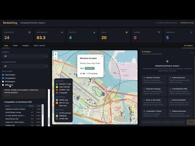
A walkthrough of the Bedashing geospatial decision-support tool — my submission for the AI Associate case study. The tool ...

10:21
Bedashing — AI-Enabled Geospatial Decision Support

12 views

3 days ago

Carmenta
Military last-mile resupply using UAS technology with geospatial analysis

WEBINAR: Military last-mile resupply using UAS technology with geospatial analysis Presented by Jonas Envall, Senior Product ...

23:02
Military last-mile resupply using UAS technology with geospatial analysis

35 views

4 days ago

Ignia
Understanding GIS | What is GIS?

Helping scholars understand the meaning and purpose of GIS and what is is used for in Geography. Follow the link below for free ...

10:09
Understanding GIS | What is GIS?

35 views

5 days ago

Ignia
Remote Sensing GIS | Raster data & Vector Data

Understanding remote sensing in GIS and the different types of data used for GIS. Follow the links to your free activity games: ...

9:02
Remote Sensing GIS | Raster data & Vector Data

6 views

4 days ago

GeoWGS84 Corp.
Top Geospatial Data Companies & Trends

The geospatial data industry has become a critical driver of modern decision-making, supporting applications such as urban ...

1:01
Top Geospatial Data Companies & Trends

2 views

4 days ago

The NDS Show
Geospatial Expert Breaks Down Satellite Imagery Embeddings

Qiusheng Wu, PhD educates us on Satellite Imagery Embeddings, what they are, how they work, how they're made, what they can ...

5:07
Geospatial Expert Breaks Down Satellite Imagery Embeddings

20 views

2 days ago

Il Riformista
Rapina in banca, a Napoli arriva il GIS Carabinieri per fare irruzione nella filiale Credit Agricole

https://www.ilriformista.it/

1:54
Rapina in banca, a Napoli arriva il GIS Carabinieri per fare irruzione nella filiale Credit Agricole

21,933 views

2 days ago

REF Flight Operations Team
Teaser: Evolution of Geospatial Sensing: Insights From Heritage to AI Era and Beyond

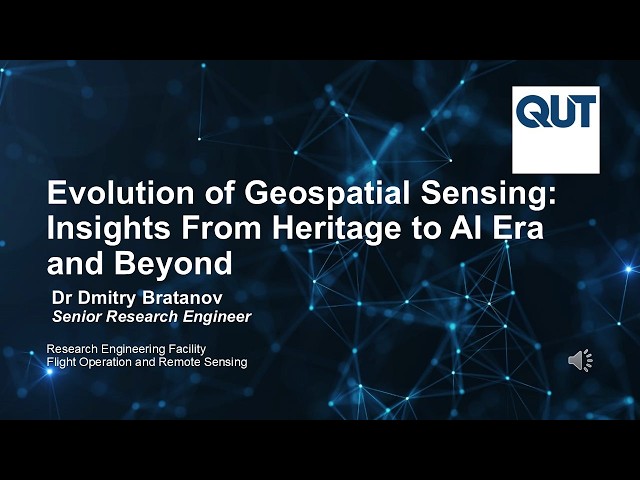
This is a teaser for a talk by Dr Dmitry Bratanov, prepared for the Brisbane Geospatial Community, 1 April 2026. "I'm excited to be ...

3:37
Teaser: Evolution of Geospatial Sensing: Insights From Heritage to AI Era and Beyond

19 views

6 days ago

Geo Spatial Intelligence PH
HOW TO CREATE WIND SPEED AND DIRECTION MAP USING ARC GIS PRO

Creating Wind speed and direction maps is critical for optimizing wind energy production by identifying ideal sites for turbines.

7:22
HOW TO CREATE WIND SPEED AND DIRECTION MAP USING ARC GIS PRO

15 views

5 days ago

Local Team
Rapina in banca a Napoli, il momento dell'irruzione dei Gis: i corpi speciali entrano all'interno

Scatta l'irruzione dei nuclei speciali dei carabinieri COPYRIGHT (Contact licensing@localteam.it for usage/license info or visit ...

6:48
Rapina in banca a Napoli, il momento dell'irruzione dei Gis: i corpi speciali entrano all'interno

302,100 views

2 days ago